
LiDAR wind measurement for wind power: mast, LiDAR or SoDAR
LiDAR wind measurement, SoDAR or mast: the accredited EWS Testing Center measures the wind at your site and delivers the report for yield assessments.
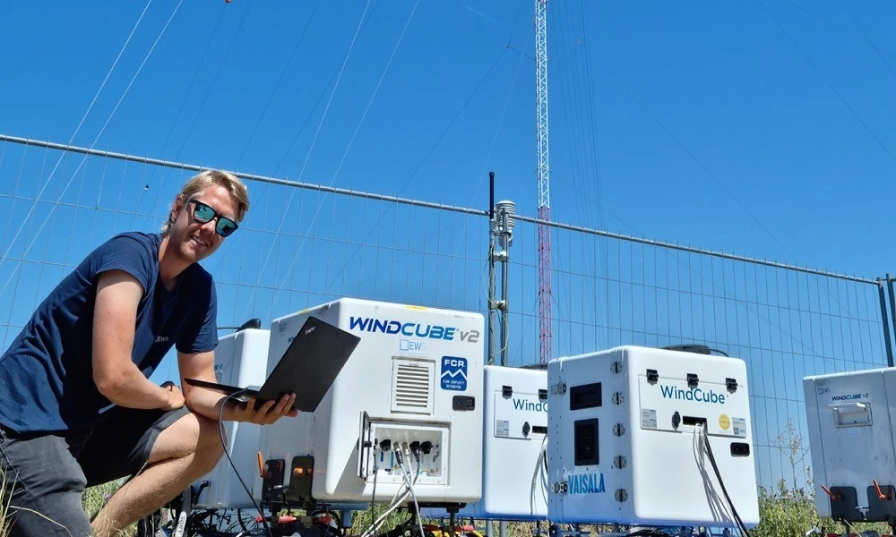
Measuring the site-specific wind potential and wind conditions is indispensable already in pre-development. LiDAR and SoDAR record the wind remotely, LiDAR with laser light, SoDAR with sound; a measurement with a met mast records the wind directly at the mast. Which method or combination suits depends on site and project. Only timely, comprehensive and professional surveys secure yields and economic viability in the long term. They need lead time, so we recommend starting as early as possible in pre-development.
For the bankability of a LiDAR wind measurement, the measurement campaign as a whole counts. A measurement period of at least twelve consecutive months is often applied so that all seasons are covered; the required duration depends on the set of rules applied. The measurement height should be as close as possible to the planned hub height; the minimum height depends on the set of rules applied, so that extrapolation to hub height carries little uncertainty. Anemometers are calibrated individually, and important sensors are used redundantly. If data are missing, the measurement is incomplete: data availability and data gaps are to be assessed and reported in accordance with the set of rules applied. The measurement data are then correlated with long-term reference data so that the short measurement year can be extrapolated to a long-term mean. Ten-minute averages of wind speed, gusts, turbulence and wind direction are usually measured, as well as temperature, which helps in assessing possible icing of the sensors. Measurement uncertainty is made up of contributions from sensors, calibration, installation and extrapolation. Distance to the planned turbine also counts: whether a mast is representative depends on terrain, altitude, roughness, wind climate and measurement duration; in complex terrain the tolerable distances are considerably shorter than in simple terrain.
In wind measurement, mast and remote sensing have different strengths. The mast delivers direct measured values with calibrated anemometers but is costly at large hub heights, because, depending on design, tilt-up masts reach only limited heights and above that other erection methods, for example with a crane, become necessary. LiDAR and SoDAR measure at several heights without a mast but need a power supply, which at remote sites often has to be autonomous, and they must be verified before use. In complex terrain a single measurement point is only of limited representativeness; there, several measurement points or combinations make sense.
The accredited EWS Testing Center handles the entire process, from measurement through RSD verification and calibration to the bankable report. The accredited measurement report forms the basis for robust wind assessments and yield forecasts, reliable site classifications (see site suitability of wind turbines) and feeds into site-specific assessments; for structural safety assessments, site- and turbine-specific proofs are additionally required. We develop individual measurement concepts for your site, have experience in complex terrain as well, and ensure a reliable power supply at remote sites. Our references include a 200-metre verification mast.